
SpaceScanX BP LT
Scanning anywhere with ease
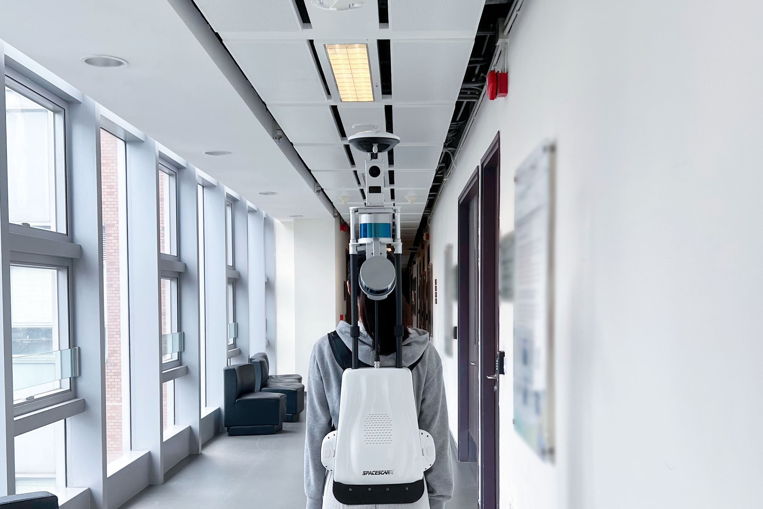
SpaceScanX BP LT
Backpack SpaceScanX mobile mapping system integrates laser scanning hardware and 3D data processing software. The key technologies of SpaceScanX include SLAM, integrated hardware system which is composed of LiDAR, 360 degree camera, GPS and IMU, and an associated data processing software system. SpaceScanX can scan and generate 3D digital models of a city, including buildings, roads, infrastructures and trees. The digital models are presented in the form of point cloud, colorized point cloud, street view, photo-realistic 3D model etc.
Our product has been pre-approved by CITF from CIC as Advanced Tools and Equipment technology.
Find Our more in https://www.citf.cic.hk/?route=search&lang=1
FEATURES
Multiple Products
The system can produce multiple products including registered point cloud, colorized point cloud, street view, measurement trajectory, 3D indoor and outdoor models etc.
Seamless Indoor and Outdoor Mapping
The data acquisition can switch seamlessly between indoor and outdoor environments without additional system reconfiguration.
Centimeter-Level High Accuracy
The system synergizes 3D LiDAR, panoramic camera, and IMU to ensure high accuracy measurement, for example, indoor, outdoor, underground.
Flexible
Multi-source point clouds can be flexibly obtained by SpaceScanX and to cope with various environments.
Real-Time Data Capture and Visualization
The trajectory of the measurement, 3D measured environment, status of sensors can be obtained and visualized in real time during the measurement.
Geo-Referenced
The system enabled real time RTK, and true coordinates of the point cloud can thus be provided.
SPECIFICATIONS
System
Weight
~ 7 kg
Size (Length × width)
1.2 m×0.3 m
Continuous working time
> 4 h
Storage
128 G
Port
HDMI, USB, USB-C
Power
15 V
Relative Accuracy*
1-3 cm
Absolute Accuracy*
5-10 cm
Output
Format: MP4, JPG, DNG
Point cloud: PCD, BIN, LAS
Laser Scanner
Measurement Range
200 m
Range Accuracy
±3 cm
3D Lidar Data Points Generated
Up to 900,000 points per second
FOV
360°
Frame Rate
20 Hz
Laser Safety Class
Class 1
IMU
Output rate
1 to 400 Hz
Attitude accuracy
±0.5° RMS (roll and pitch), ±1.0° RMS heading (typ)
Bias instability
±15 μg (Accelerometer); 18°/hr (Gyroscope)
Noise density (standard)
60 μg/√Hz (Accelerometer); 0.03°/sec/√Hz (Gyroscope)
GNSS
Signal tracked
GPS/QZSS L1C/A, L2C; GLONASS L1OF, L2OF; BeiDou B1I, B2I; Galileo E1-B/C, E5b
Update rates
Up to 5 Hz
Kinematic positioning
7 mm + 1 ppm (H.) 14 mm + 1 ppm (V.)
Camera
Panoramic images
Yes
Optics
Dual-fisheye panoramic camera
Resolution
5769×2880
FPS
29.97
Megapixels
16.6
Field of View
~ 100% (360°×180°)
Note
* Depending on the environment
~ Approach to