
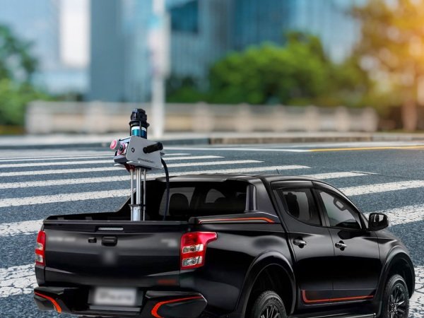
Vehicle-based Mobile Mapping System
The vehicle-based SpaceScanX mobile mapping system integrates high-precision laser sensors, HDR panoramic cameras, GNSS devices, and inertial navigation systems, enabling continuous acquisition of vast spatial data in dynamic environments and accurate completion of measurement tasks. It is adaptable for installation on diverse carriers, including cars, trains, and ships, and adeptly handles multifaceted tasks while efficiently collecting high-density and high-precision point cloud and image data during vehicular operation. These features collectively position it as a highly innovative mobile mapping system.
FEATURES
Fast 3D scanning for large-scene urban mobile mapping
Capturing various types of data, including high precision lidar data, high resolution image and high accuracy location data
Multiple sensor integration for high-accuracy mapping
Intelligent and automatic data collection
Support HD mapping for autonomous driving, road defects detection, and road side object recognition etc
Flexible in adjusting the height of system platform for various environment
Real-time 3D data acquisition
Simplicity in design, easy to mount on vehicles
Latest SLAM technology
SPECIFICATIONS
Laser Scanners
Range Accuracy
±3 cm
3D Lidar Data Points Generated
500,000 to 1,800,000 points per second